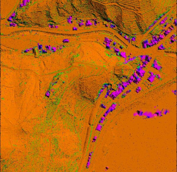
LiDAR
Light Detection and Ranging (LiDAR) can determine how far objects are away from each other by shining a laser onto a target and analyzing the light that bounces back. LiDAR is used to create incredibly detailed maps in addition to assisting researchers in the fields of geography, archeology, geology, seismology, atmospheric sciences, laser studies, and much more.
LiDAR data processing is most effective in the field of geographical system and of remote sensing for creating Digital Elevation Model, Digital Terrain Model and many other surface models. We have the complete understanding of all types of data in LiDAR system and has developed custom built utilities for easy classification of LIDAR points.
3D Modelling & Meshing
EOM offers a suite of 3D modeling products designed for 3D visualization, GIS applications, architectural modeling, 3D modeling, 3D graphic design, and 3D simulators.
Bare Earth/Digital Terrain Model
The laser pulses emitted from airborne lidar systems may be reflected from man-made structures, vegetation, or the earthen surface. A single pulse may reflect from upper, middle, and lower tree canopy as well as the ground beneath, resulting in multiple measurable returns from that pulse. The elevation of the reflected surface(s) is derived based on the amount of time it takes for an emitted pulse to return to the sensor, sensor position, and other parameters. The full set of discrete returns and their corresponding x, y, z coordinates are stored in what is referred to as a ‘point cloud’ dataset.
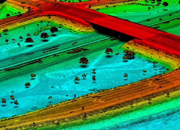
BATHYMETRY
Bathymetry is the information that describes the topography of the seabed, as depth from the sea surface to the seafloor. Bathymetric Lidar is a technique to capture geospatial data of the coastline and (shallow) waters. It is a method potentially facilitating efficient and fast creation of hydrographic data.
It offers a cost effective solution to wide area surveys that are impossible, difficult or expensive to access or complete using conventional acoustic systems.
Safe ocean navigation relies on accurate bathymetry data, which are also essential for planning marine installations and infrastructure such as wind turbines, coastal defences, oil platforms and pipelines. Fundamental to understanding risk in areas of high susceptibility is capturing the near-shore land and sea surface.
Bathymetric Lidar is the most effective and cost-efficient technology to capture both the land and seafloor simultaneously to provide a continuous, detailed 3D elevation model along the coastline. Its ability to successfully capture elevation on both sides of the coastline.
EOM provides highly accurate Bathymetry post processing products and having dedicated LiDAR classification personnel.
EOM Bathymetry process output:
- Ground
- Underwater Ground
- Underwater vegetation
- Water level
Benefits with this process:
- Multibeams and single-beam high precision bathymetric surveys (marinas, port facilities, rivers, lakes and oceans)
- Shoreline erosion monitoring
- Dredging and underwater construction work monitoring and surveillance