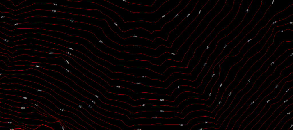
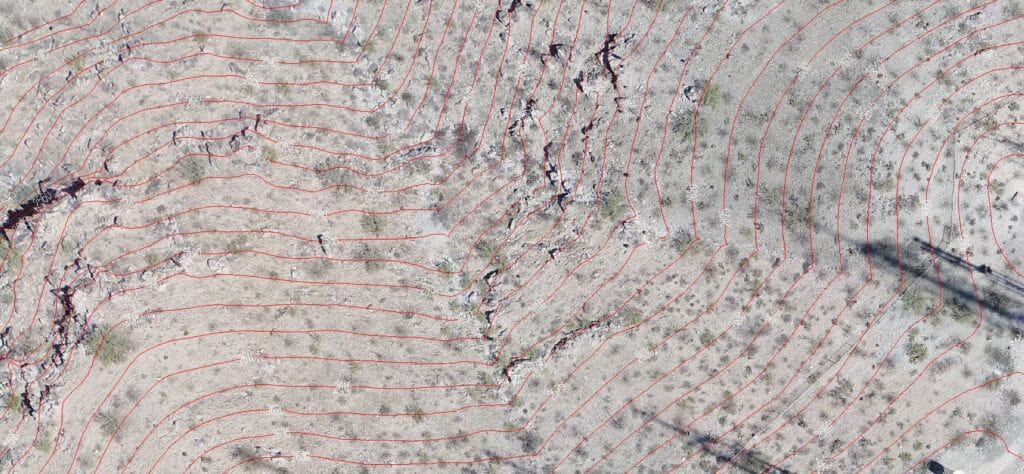
DEM / DTM Generation
A Digital Elevation Model (DEM) is a specialized database that represents the relief of a surface between points of known elevation. By interpolating known elevation data from sources such as ground surveys and photogrammetric data capture, a rectangular digital elevation model grid can be created.
A digital elevation model (DEM) can sometimes contain pixels with failed or incorrect values. You can edit a DEM to smooth out such irregularities to create a more accurate model and, in turn, generate more accurate orthorectified images. For example, areas, such as lakes, often contain misleading elevation values
In many cases, you may need to convert a DEM from a digital surface model (DSM) to a digital terrain model (DTM). A DSM represents the elevation surface, including objects, such as buildings and trees, whereas a DTM represents a bare-Earth elevation surface. For this reason, using a DTM to perform orthorectification generally produces better results. However, a DEM extracted from overlapping images is a DSM; it first should be converted to a DTM, and then edited before using it for orthorectification.
EOM provides high-quality Digital Elevation Models. We place great emphasis on accurate terrain representation by collecting additional spot elevations and break lines thereby ensuring the highest quality deliverables.
There are certain processes which are following before deliveries.
- Interpolation of height at any terrain point.
- Plots of contours with user-specified contour intervals.
- Generation of longitudinal and cross section profiles.
- Plots of isometric and perspective images.
- Volume calculations, including computation of cut and fill.